Direction changes in Japan during past 2ky
sorry for under construction
Secular variation model by Shibuya(1980)
Shibuya (1980) compiled archeomagnetic data from Japan and made a secular variation curve on I-D dimension.
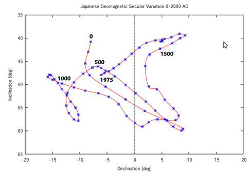
horizontal axis = declination (positive value shows eastward), vertial axis = inclination (positive value shows downward),
Direction of geomagnetic field has changed such as above figure during the past 2000 years. So, project this dataset on the surface of Google Earth globe as a unit sphere.
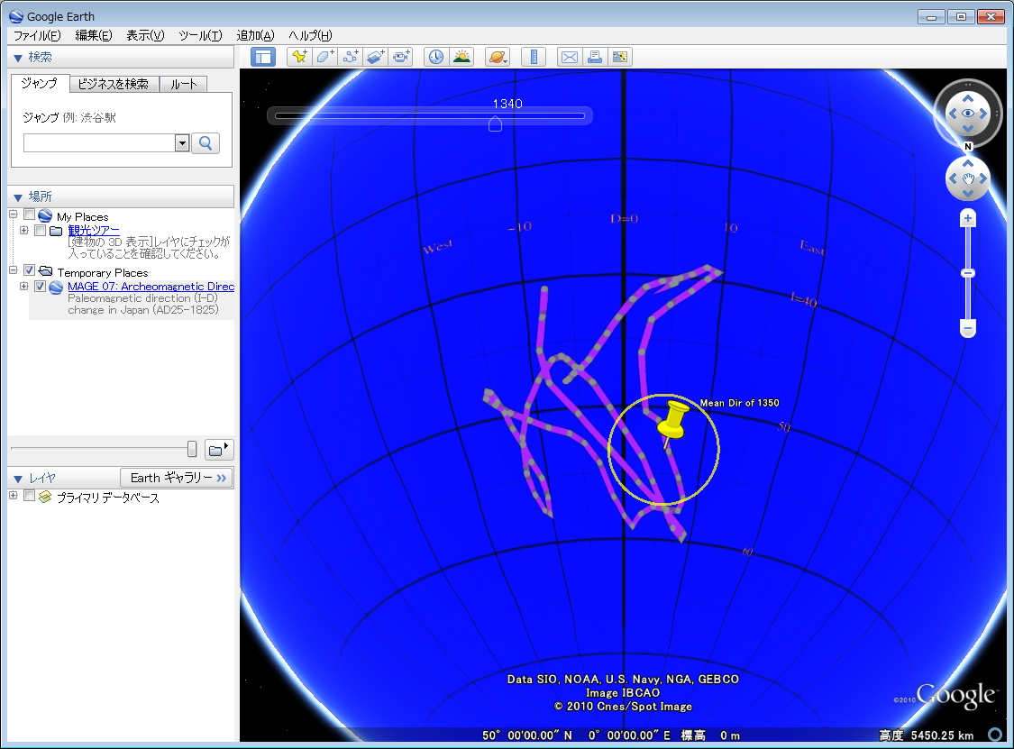
Screenshot: click to zoom up
This is so different in region of steeper inclination from plot on a plane shown in figure above.
KML file:
- Direction changes in Japan for 2ky based on Sakai, Osaka (Shibuya, 1980) MAGE07-2ID_S80_20100703.kmz (226kB)
Reference:
Shibuya H., Geomagnetic secular variation in Southwest Japan for the past 2,000 years by means of archaeomagnetism,
M.E. thesis, Faculty of Engineering Science, Osaka University, pp. 54, 1980.
Paleomag with GE << Direction changes in Japan 2ky